Living in South Florida, many of us become amateur meteorologists every summer. With each tropical wave that forms, we watch it casually until a few become a tropical system. Tropical cyclones are an awesome sight and a reminder of the power of nature.
Most tropical storms spawn from waves created by thunderstorms coming off the West African coast.
Just south of the Sahara, the wet season brings many storm systems that will eventually migrate west with the trade winds and cross the Atlantic. The systems traverse the tropics as a wave and create stormy weather. Slowly, due to the Earth’s curvature, the wave starts to gain momentum in its spin. The spin will cause some of these waves to curve around themselves, and create a self-contained circulation. The spin in the Northern Hemisphere is counter-clockwise and in the Southern Hemisphere, clockwise.
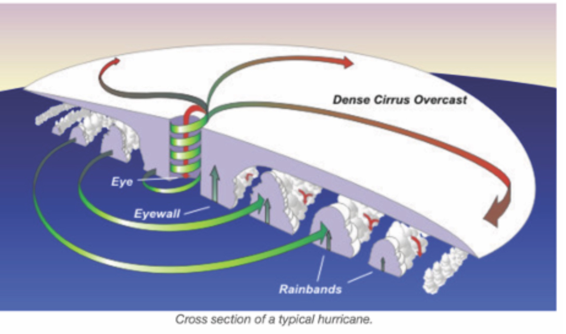
Like a giant vacuum, a tropical storm draws in the warm air underneath it. The warm air rises and energy is released as it cools in the upper atmosphere. Cooled air will either flow out of the core or fall back into the center of the core, the eye of the storm. The more efficiently this occurs, the stronger the storm tends to be. This is why you may notice a more defined circulation pattern and eye as the storm intensifies.
Wind shear is when the wind flows in different directions
for a short distance and can be either vertical or horizontal. Storm circulation can be sheared vertically by crosswinds at different altitudes, hindering the strengthening of the storm. Just recently, Hurricane Marco’s mid-level storm clouds were sheared off by its low-level core as it approached the gulf coast. Losing its vertical circulation, the storm quickly lost strength. Just a day later, Hurricane Laura, with no wind shear to disrupt the flow, was able to strengthen to a Category 4 hurricane.
Laura was able to take advantage of what the National Hurricane Center calls “conditions that are conducive to development,” which means you will often see the major strengthening of a storm. In other words, this is when a storm is undisturbed by crosswinds, often resulting in an explosive intensification of the storm.
For South Florida, some of the strongest hurricanes coming our way tend to be Cape Verde hurricanes. They originate from tropical waves near Cape Verde, an island country in the central Atlantic, and slowly travel eastward as they gain latitude and strength. These hurricanes will typically form in August and September but can start as early as July, and continue well into October.
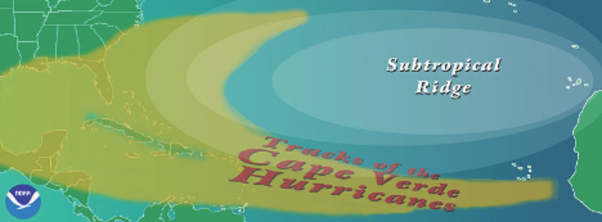
These Cape Verde hurricanes are often steered by a high- pressure (ridge) system that typically sits over Bermuda in the late summer. High-pressure systems create clockwise circulation that helps push the storms eastward until they get past the ridge. At this point, the storm typically begins moving north.
Because the wind currents that steer the storm are different at various altitudes, the net direction of the storm is often affected by its size and strength. For example, if there is a westerly wind at high altitude and easterly wind at low altitude, the storm will get pushed eastwards when the storm is weak; when the storm is strong, it will be affected by both and end up being almost static, as was the case with Hurricane Dorian in 2019.
So the next time you watch a forecast on TV or read an update from the National Hurricane Center analysis on http://nhc.noaa.org, you should be familiar with the terms used. If you are a weather junkie like me, I recommend the Youtube channel TropicalTidbits, along with its website https://tropicaltidbits.com for a detailed analysis of each storm threatening us.
By Li Pan