
El Niño describes a phenomenon in which eastern Pacific waters are warmer than average. It has wide-ranging impacts across the world, and it has started.
It may not be obvious why weather patterns in the Pacific should impact us here on the coast of the Atlantic. But years of data show a consistent relationship that Floridians should be aware of.
For June, the average temperature along the eastern Pacific has risen to an average of 0.8C above normal; this is a relatively quick change from the La Niña conditions that were dominant for the past few years, which coincides with very active tropical storm seasons. Whereas, El Niño is expected to deter the formation of Atlantic tropical storms.
So why is that?
Traditionally, the very warm waters off the western Pacific, near the Philippines, are where the water vapor rises, then falls on the eastern Pacific. This was first identified by Gilbert Walker in 1904.
When El Niño happens, the Pacific waters off South America are warmer than average. This causes stronger rising air, which inverts the typical trade-wind patterns in the Pacific.
This new center of air rising on the eastern portions of the Pacific means that air will fall down from high in the atmosphere near the western U.S., and the tropic Atlantic waters.
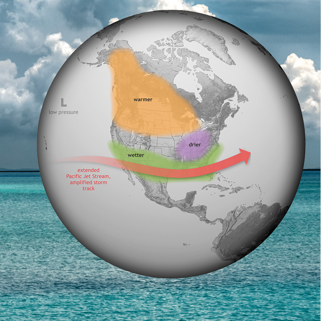
One early indication of this is that it is drier than normal in Canada, where the wildfires have been flaring up. The warm air that rises falls down near western Canada, causing warmer temperatures there. El Niño is also contributing to this due to a lower jet stream, and it’s causing more storms to travel along the southern states. This impacts Florida, and we will likely see above-average rainfall near us. This will also mean drier conditions in the states along the Great Lakes.